
Palabras clave
Panama
Totuma
Tisingal
Colorado River Represa
Panamá
Totuma
Tisingal
Río Colorado
Cómo citar
Resumen
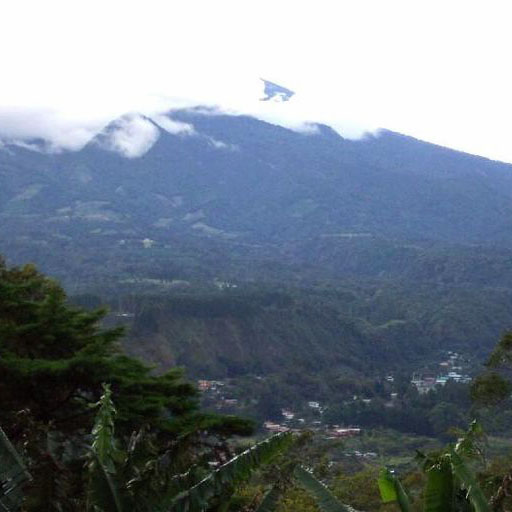
Bajos de Totuma Hydropower Project study area is located in west Panama, near to Costa Rica-Panama border line. The hydraulic scheme of the project includes a small intake in the Colorado River, an initial conduction, a superficial pipeline, pressure tank, penstock, a powerhouse and generates 5 MW of power. Subduction dynamics process south of the study area is complex, standing out structures such as Panama Fracture Zone, Cocos Ridge, Tisingal and Tisingal volcanos. The study area is composed mostly by Paleogene-Neogene bedrock and Quaternary age volcanic rocks and materials (pyroclastic-epiclastic, PE) originated in West Panama volcanic range (Tisingal and Tisingal volcanos, which are among the highest mountains in Panama). BTHPP is located in a complex volcanic geological setting. Many different types of volcanic rocks and related materials are present along project scheme. It is highly probable that most of those materials were originated during Tisingal volcano major explosive activity some 1.6 million years ago, so probably most of the rocks in the area are allochthonous and/or related to major Tisingal lateral explosion and resulting pyroclastic flow some 1.6 million years ago. Despite major stratigraphic uncertainties, this investigation contributes to a relative fair understanding of the geotechnical conditions and parameters present in every project proposed work, this is, intake, tunnels, conducting pipelines, surge tank, penstock, and power house.
Citas
Camacho, E. (2003). Sismotectónica del extremo norte de la Zona de Fractura de Panamá. Tecnociencia, 5(2), 139-152.
Camacho, E. (2009). Sismicidad de las tierras altas de Chiriquí. Tecnociencia, 11(1), 119-130.
Colegio Federado de Ingenieros y de Arquitectos de Costa Rica. (2010). Código sísmico de Costa Rica 2010. Cartago, Costa Rica: Editorial Tecnológico de Costa Rica.
Cowan, H. A. L. Sánchez, E., Camacho, J., Palacios, A., Tapia, D., Esquivel, I. D., & Lindholm, C. (1995). Seismicity and tectonics of Western Panama from new portable seismic array data. Final report to the Research Council of Norway. Kjeller, Noruega: NTNF-NORSAR. Manuscrito inédito.
Empresa Propietaria de la Red S. A. (EPR). (2003). Línea de transmisión eléctrica 230 kV. Proyecto SIEPAC, tramo Panamá. Estudio de impacto ambiental, 1 (1). Manuscrito inédito.
Junta Técnica de Ingeniería y Arquitectura (2014). Reglamento Estructural de Panamá. Sociedad Panameña de Ingenieros y Arquitectos: Panamá.
Morell, K. D., Gardner, T. W., Fisher, D. M., Idleman, B. D. & Zellner, H. M. (2013). Active thrusting, landscape evolution and late Pleistocene sector collapse of Barú volcano above the Cocos-Nazca slab tear, South Central America. Bulletin of the Geological Society of America, 125(7-8), 1301-1318. doi: 10.1130/B30771.1
Restrepo, J. F. (1987). A geochemical investigation of Pleistocene to Recent calc-alkaline volcanism in western Panama. (Unpublished Master Thesis). University of South Florida, Florida, United States.

Esta obra está bajo una licencia internacional Creative Commons Reconocimiento-NoComercial-CompartirIgual 3.0.
Derechos de autor 2020 Roberto Protti, Dennis Sojo